Heightfields
Efficient terrain generation in Houdini
What Are Heightfields?
Heightfields are 2D grids storing elevation values—ideal for fast, memory-efficient terrain in Houdini. Each cell holds a single height, making them perfect for large landscapes.
When to Use
- Interactive sculpting and non-destructive workflows
- Procedural effects like erosion, masking, layering
- Export as images or meshes for other software
- Terrain fits a height map (no caves/overhangs)
Efficiency
- Much less memory than meshes or VDBs
- Fast operations—millions of points with minimal resources
- Example: 2048x2048 heightfield ≪ mesh/VDB of same resolution
Limitations
- Only one height per (x, y)—no caves, tunnels, overhangs
- Use geometry or VDB for complex 3D shapes, volumetrics, or custom mesh topology
Common Nodes
- HeightField: create terrain grid
- HeightField Erode: simulate erosion
- HeightField Mask: mask terrain areas
- HeightField Project: project geometry onto terrain
- HeightField Convert: turn heightfield into polygons
Export & Interchange
- Export as EXR, PNG (images), OBJ, FBX (meshes), or volumes
- Compatible with Unreal, Unity, Blender, etc.
- Check resolution, scale, format for your target app
Transferring Heightfield Attributes to Geometry
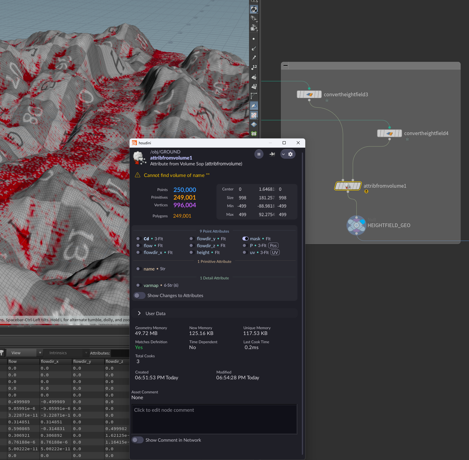
How to transfer heightfield attributes to geometry:
- Use Convert Heightfield nodes to convert heightfield layers (e.g. Height, Mask) to geometry.
- Plug the converted layers into an Attribute From Volume node.
- The resulting geometry will have the heightfield attributes (such as height, mask, flowdir, etc.) transferred over.